AQUARIUS Funding Call – Marine and Freshwater Infrastructure Access: Open 02 September 2025 – 28 October 2025
AQUARIUS Funding Call – Marine and Freshwater Infrastructure Access: Open 02 September 2025 – 28 October 2025
CETAIR aims to validate UAV-based methods to estimate cetacean density and abundance from aerial imagery in offshore renewable energy monitoring contexts.



Research Infrastructure Used: UL Drone
“CETAIR will help bridge the gap between innovative drone technologies and the practical monitoring needs of offshore renewable energy projects. By combining UAV imagery, distance sampling and AI, we aim to make cetacean monitoring more scalable, safer and more cost-effective, while maintaining the robustness required for environmental assessment and decision-making.”
Inês Machado, WavEC Offshore Renewables
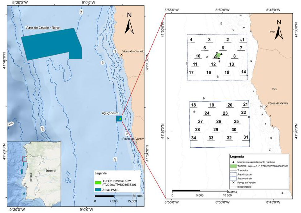
CETAIR aims to validate UAV-based methods to estimate cetacean density and abundance from aerial imagery in offshore renewable energy monitoring contexts. Using the UL Drone infrastructure, the project will conduct UAV surveys in the North of Portugal, focusing on the Aguçadoura test site and the Viana Norte offshore area, and will co-collect UAV imagery with ongoing vessel-based marine mammal surveys where applicable. The project will adapt distance sampling to UAV imagery by reconstructing perpendicular distances from camera geometry, optimise flight parameters such as altitude, ground sample distance, flight speed, viewing angle, sea state and glare, and validate AI-based detection, counting and tracking of small delphinids. Expected outputs include survey designs and flight plans, field test results, an integration and validation report, and a public Best Practices and Operational Guidance document to support scalable, non-invasive and regulator-ready marine megafauna monitoring.
MORE INFORMATION
AQUARIUS TA Project Name:
Cetacean Aerial Imagery for Robust Density and Abundance Estimation
Project acronym:
CETAIR
TA Project Unique ID:
69
Partners involved:
• WavEC Offshore Renewables
• University of Limerick
Start date
1st of July 2026
End date
30th December 2027
Mission Lighthouse Region
Atlantic-Arctic
Work/research geographical
area
Bay of Biscay and Iberian Coast (BBIC);
Portugal
Northwestern Coast of Portugal
Names of RI facilities used
UL Drone
Scientific discipline(s)
Earth Sciences & Environment: Marine science/Oceanography
Principal Investigator
(PI) Affiliation
WavEC Offshore Renewables