AQUARIUS Funding Call – Marine and Freshwater Infrastructure Access: Open 02 September 2025 – 28 October 2025

Infrastructure Profile
Infrastructure Provider

Location
University of Limerick
Organisation & Address
University of Limerick, Limerick, Ireland
Link to Vessel/Infrastructure Schedules (if applicable)
NA
Normal Area of Operation
Ireland, but can be used in other countries – depending on shipping/transport costs
Maximum Number of Days Available
14 days
Scientists’ Travel and Logistics (T&L) Budget Available
€ 2,000.00
Overview
Depth Rating
400 m
Length
1.2 m
Width
1 m
Height (incl. draft for USV)
0.8 m
Weight in Air
120 kg
Total System Weight
200 kg
Payload
20 kg
Scientific and Technical Specifications
General Information
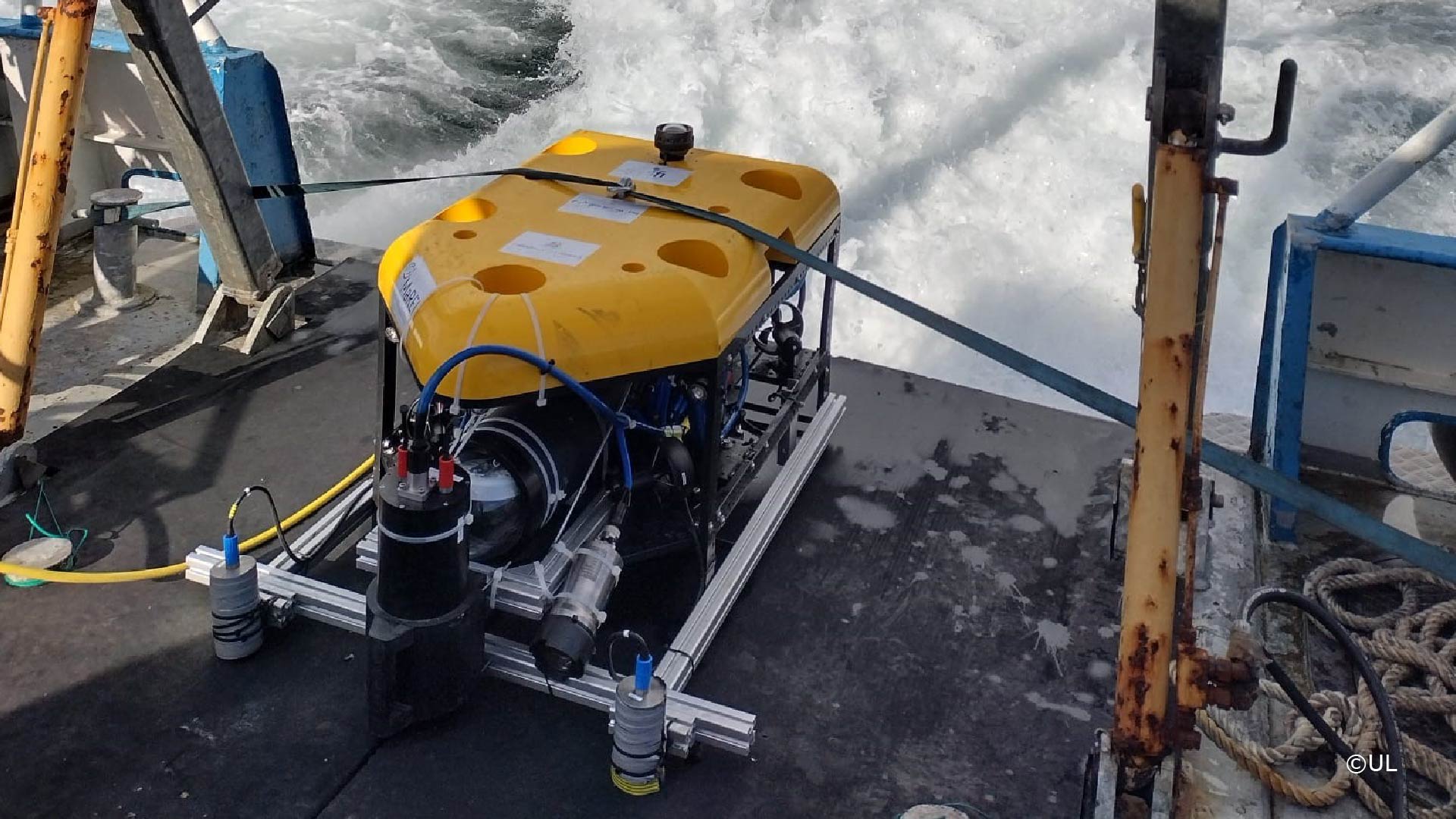
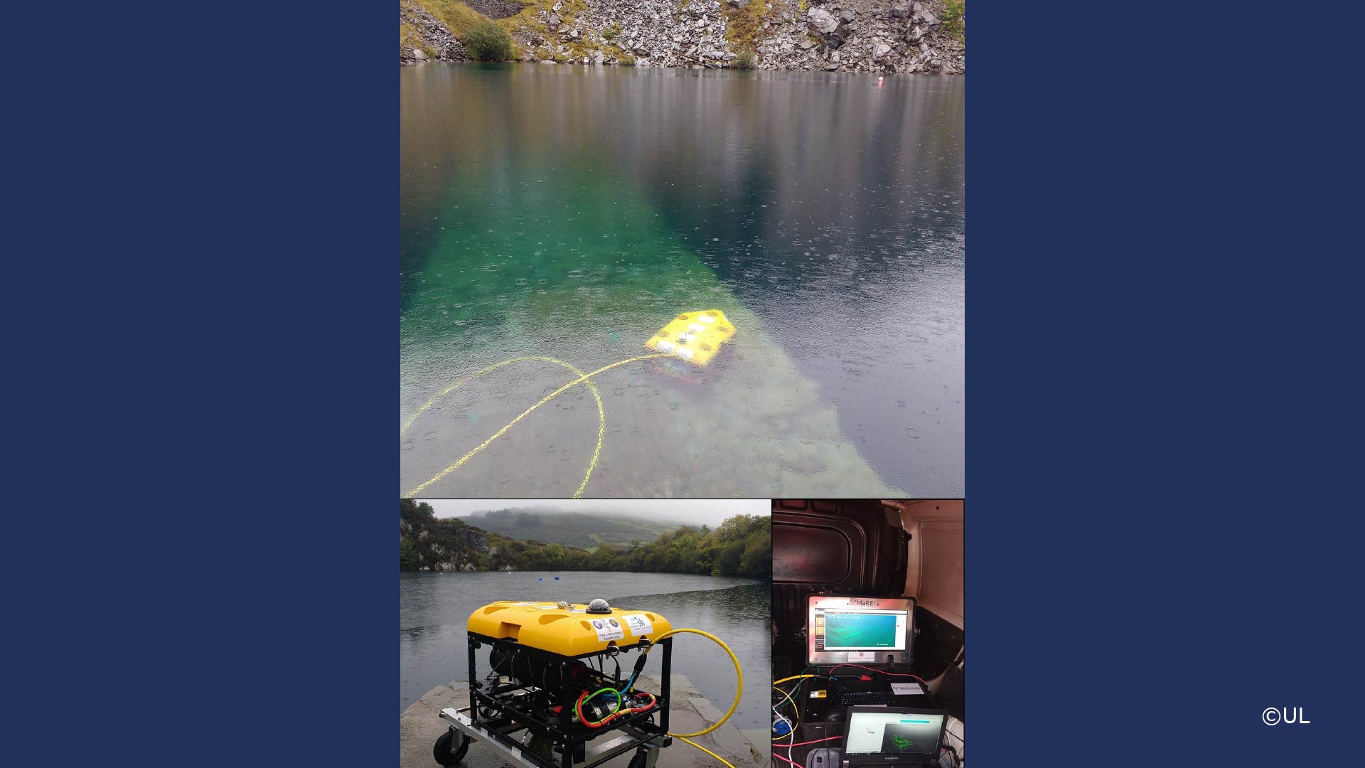
I-ROV is a 400 m light inspection class ROV with advanced OceanRINGS control systems. Onboard instruments include IXBLUE ROVINS Nano coupled with Nortek DVL offering very accurate navigation, OceanRINGS offers manual control through to semi-autonomous control and through to fully autonomous control modes. The ROV offers accurate positioning and waypoint following subsea, a capability that is not generally available on commercial ROVs.
The IROV system has survey grade navigation capability, allowing for survey grade deliveries. Payload capability is over 20 kgs with typical survey instruments including multibeam Sonar, Laser line imaging, 4K video, environmental sensor suite and still camera / strobe for photogrammetry. The IROV is also capable of performing some basic water & sediment sampling work. The system can perform these operations with precise GPS-relative positioning subsea.
Vessel Requirements (if applicable)
A vessel that can hold position i.e. DP or anchoring
Thrusters
8 (4 vertical, 4 horizontal)
Cameras
HD (multiple), DSLR photo with strobes, low light, multispectral
Positioning (USBL, etc.)
IxBlue ROVINS Nano INS, submersible GPS, can accept USBL etc
Instruments/Scientific Payload
The IROV system has survey grade navigation capability, allowing for survey grade deliveries. Payload capability is over 20 kgs with typical survey instruments including multibeam Sonar, Laser line imaging, 4K video, environmental sensor suite and still camera / strobe for photogrammetry. The IROV is also capable of performing some basic water & sediment sampling work. The system can perform these operations with precise GPS-relative positioning subsea.
Manipulators
None
TMS (Tether Management System (ROV ONLY)), LARS details (if applicable)
No TMS, topside reel hand fed
Support offered to AQUARIUS users
The access includes integration work for user hardware and software. The access also includes operators, pilot + 2 technicians, during the operational days. These operators will complete all parts of the mission, effectively performing all subsea navigation and operations required for the user. The access also includes some cost for small boat operations per day (typically small coastal Rhib or boat).
The minimum access is 3 days of operations with typical access being 7 days. The access includes training of the system, expected output including working on navigational data and survey data streams. There is some preparation work such as integration and training included, this is done prior to operational days. The user can be onsite during operation or have access through a virtual component.
The access allows for full integration of user hardware and software to the IROV platform. The datasets from operational days in the desired format will be provided to the end user. This service and operational capabilities is not typically available in the market. We can place the ROV at a specific GPS coordinate or list of coordinates (waypoints) subsea. Overall operations can be for inspection work or some light intervention work (sampling).
Infrastructure Availability and Contact Details
Year 2025
Flexible on location of operation in Ireland and possibly abroad. Available all months.
Year 2026
Flexible on location of operation in Ireland and possibly abroad. Available all months.
Year 2027
Flexible on location of operation in Ireland and possibly abroad. Available all months.
Contact email for applicants to discuss the initial feasibility of their work while they prepare their application
gerard.dooly[at]ul.ie
Certification and Clearance Requirements
Diplomatic clearances or permits required for area or type of activity
None, but would need to review area of operations
Additional training required
The access includes training of the system, expected output including working on navigational data and survey data streams. There is some preparation work such as integration and training included in the unit cost, this is done prior to operational days. The user can be onsite during operation or have access through a virtual component. The training will be provided and organized by the Infrastructure Operator.
Additional Resources