AQUARIUS Funding Call – Marine and Freshwater Infrastructure Access: Open 02 September 2025 – 28 October 2025

Infrastructure Profile
Infrastructure Provider
Location
Mol, Belgium
Organisation & Address
VITO, Boeretang 200, 2400 Mol, Belgium
Link to Infrastructure Schedules (if applicable)
NA
Maximum Number of Days Available
For Sentinel-2 revisit: see User Guides – Sentinel-2 MSI – Revisit and Coverage – Sentinel Online – Sentinel Online (copernicus.eu)
Sentinel-2 satellite revisit (in the absence of clouds) every 5 days or 10 days between July 2015 and today
Maximum Number of Scientific Berths Available
€ 2,666.67
Overview
Coverage Width
290 km wide
Image Resolution
10, 20, 60 m (depending on the spectral band)
20 m
10 m
10 m
Sensors Available
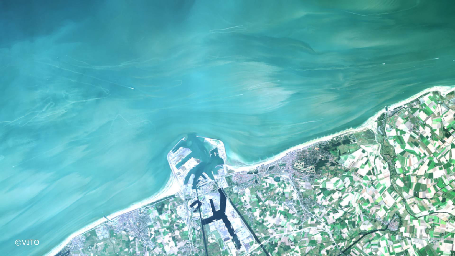
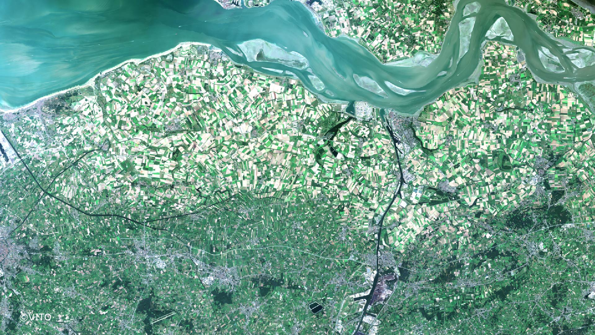
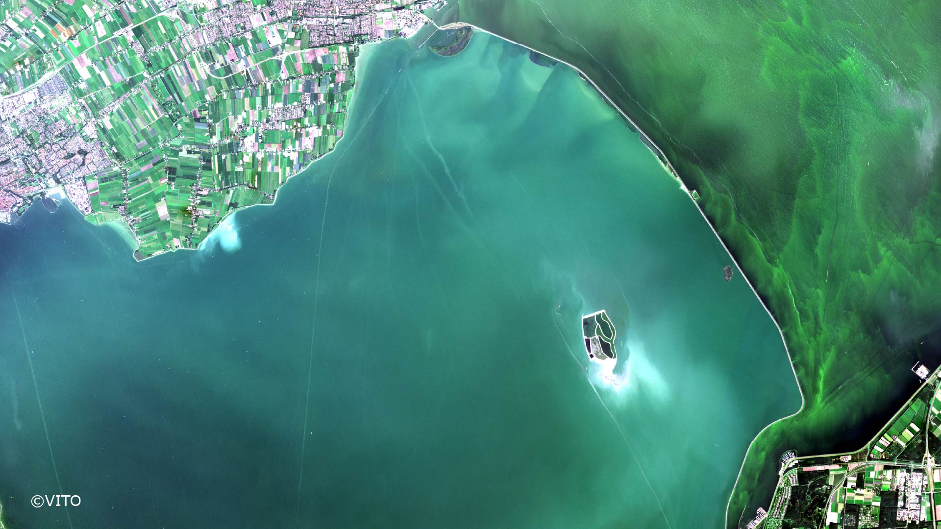
Sentinel-2 for Water leaving reflectance (RHOW)
Sentinel-2 for Chl-a
Sentinel-2 for Turbidity
Sentinel-2 for Suspended particulate matter
Algorithm Theoretical Baseline Document (ATBD)
Terrascope Documentation Portal
ATBD Water-leaving reflectance (RHOW)
ATBD Water Quality products (Chl-a, Turbidity, Suspended Particulate Matter
More info here
Scientific and Technical Specifications
General Information
For Sentinel-2 coverage: Sentinel-2 MSI – Revisit and Coverage – Sentinel Online – Sentinel Online (copernicus.eu):
Region of Operation:
- all continental land surface (incl. inland waters) between latitudes 56° South and 82,8° North
- all coastal waters up to 20 km from the shore
- all islands greater than 100 km2
- all EU islands
- the Mediterranean Sea
- all closed seas (e.g Caspian Sea)
Terrascope offers the processing of Sentinel-2 satellite tiles into water leaving reflectance and derived products of Chl-a, turbidity and suspended particulate matter.
The scientific and technical details of the water leaving reflectance (RHOW) and the derived water quality products are in the ATBDs available at the Terrascope Documentation Portal
The unit of access is 1 area of 10 tiles (1 tile = 110 x 110km) for 10 historic years.
The user provides the operator
- a list of max. 10 tiles from the Sentinel-2 tiling grid kml available for download here
- the time range (between July 2015 and today)
Scientific Limitations
Scientific Limitation: See ATBDs available at the Terrascope Documentation Portal
Support offered to AQUARIUS users
2 Meetings
Training material available at terrascope.be/en user support
Terrascope helpdesk at info[at]terrascope.be
Infrastructure Availability and Contact Details
Year 2025
Sentinel-2 revisit (in absence of clouds): every 5 days or 10 days
Year 2026
Sentinel-2 revisit (in absence of clouds): every 5 days or 10 days
Year 2027
Sentinel-2 revisit (in absence of clouds): every 5 days or 10 days
Contact email for applicants to discuss the initial feasibility of their work while they prepare their application
Please direct all queries to the AQUARIUS Coordination Office: aquarius[at]marine.ie
Certification and Clearance Requirements
Are any permits required for operations?
No
Additional clearances or documentation required for an area or type of activity
NA
Training materials
- Terrascope webinar recording (vimeo): Monitoring water quality with satellites and drones (VITO) https://vimeo.com/644077787
- Terrascope webinar recording (YouTube): Monitoring water quality with satellites and drones (VITO) https://youtu.be/wedPxtKRG70
- User support section (with FAQ, Forum, Documentation portal, How to videos, Education, Webinars) at https://terrascope.be/en
- An introductory webinar recording ‘Monitoring water quality with satellites and drones’ (from 9 Nov 2021) is available at https://terrascope.be/en/news-events/terrascope-webinars