AQUARIUS Funding Call – Marine and Freshwater Infrastructure Access: Open 02 September 2025 – 28 October 2025
South Adriatic Sea E2M3A EMSO Regional Facility
Mediterranean Moored Multi-Sensor Array - Eastern Mediterranean 2 research facility


Infrastructure Profile
Infrastructure Provider

Location
South Adriatic Pit
Organisation & Address
National Institute of Oceanography and Applied Geophysics – OGS, Borgo Grotta Gigante 42/c, 34010 Sognico (TS), Italy
Link to Infrastructure Schedules (if applicable)
NA
Normal Area of Operation
40.75° N – 42.5°N / 17.0°E – 18.25°E
Maximum Number of Days Available
182 days
Scientists’ Travel and Logistics (T&L) Budget Available
€ 6,000.00
Overview
Depth of Operation
1200 m
Power Supply
Photovoltaic system with batteries storage
Communication System(s)
Google Cloud via Iridium Certus broadband network
Dimensions
Two mooring lines system: principal mooring 1200m line (buoy), secondary mooring 1000m line
Sensors Available, Scientific Payload etc.
Sea Temperature, Salinity, Conductivity (at 2 m, 15 m, 120 m, 220 m, 350 m, 550 m, 750 m, 900 m, 1000 m, 1200 m)
Oxygen (2 m, 15 m, 350 m, 750 m, 1200 m)
pH (2 m) and pCO2 (2 m, 1200 m)
Currents ADCP (0-300 m; 320-1000 m ; Single point 1200 m)
Sediment fluxes (120 m, 1150 m)
Turbidity and transmittance (350 m)
Meteorolocial measurements, Irradiance measurements
Latitude/Longitude (water column)
Scientific and Technical Specifications
General Information
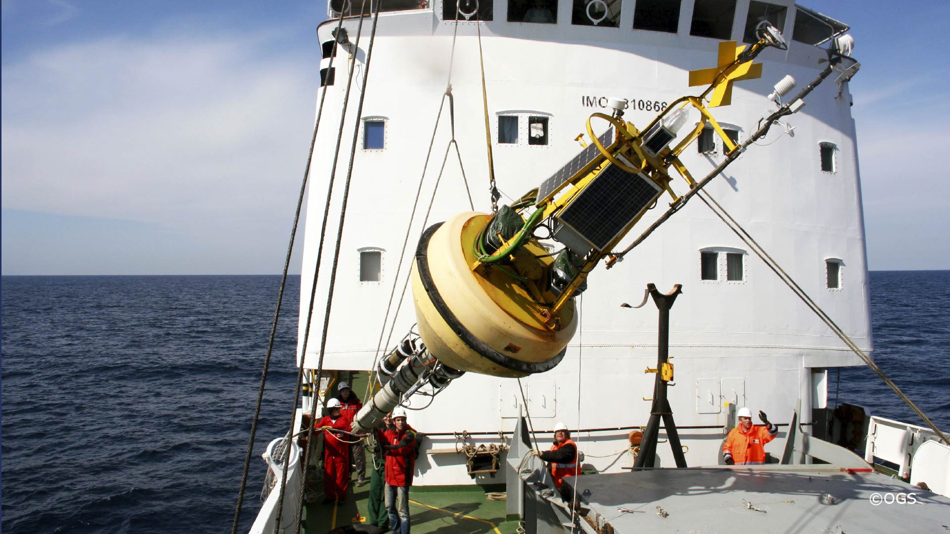
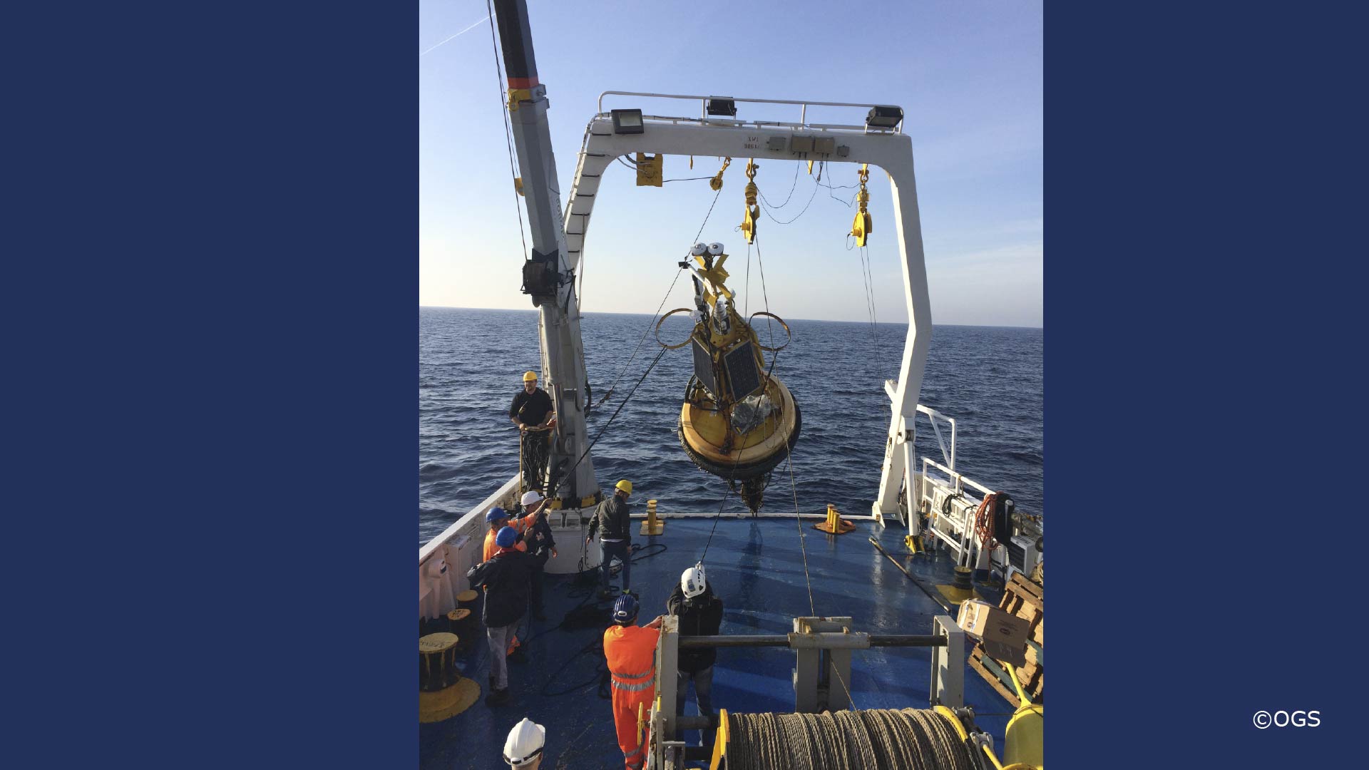
The E2M3A site is a two mooring system where the main one hosts the surface buoy instrumented with meteorological station and radiometers to collect air-sea interaction measurements, sensors for physical (temperature and salinity) and biochemical (oxygen, partial CO2 and pH) parameters distributed in the mixed layer, telemetry and services. The surface buoy collects the acquired data and transmits them in real time to the on-line server. The secondary mooring line houses an instrumental chain with sensors at different depths for physical and chemical measurements from the sea floor to the intermediate layer. The site has been working almost continuously since 2006 and provides the longest high-resolution time series of physical parameters in the open sea to assess the response of the Adriatic to climatic influences. It is devoted to the study of dense water formation processes, water mass properties, biogeochemical cycles and cascading in the southern Adriatic Sea, and to the understanding of ecosystem functions, especially related to carbon sequestration dynamics and acidification processes in deep waters.
The site provides data in NRT (surface layer and meteo), while the intermediate and deep layers are made in delayed mode. NRT of the thermohaline measurements of the intermediate and deep layers will be available after 2025.
Support offered to AQUARIUS users
Logistical, technological, and scientific support for all installations can be offered by OGS. Data intercomparison between mooring buoy and external devices can be performed (e.g., profiling floats and standard ship based CTD measurements). Beside logistical, technological, and scientific support for all installations, gliders data are available with ocean sampling mission package: salinity, temperature, depth, CDOM, Chlorophyll-a, oxygen.
Infrastructure Availability and Contact Details
Year 2025
January to December depending of the ship-time for the maintenance
Year 2026
January to December depending of the ship-time for the maintenance
Year 2027
January to December depending of the ship-time for the maintenance
Contact email for applicants to discuss the initial feasibility of their work while they prepare their application
vcardin[at]ogs.it
Certification and Clearance Requirements
Diplomatic clearances or permits required for area or type of activity
No further documentation is needed
Additional training required
Currently, Italian ships require a certificate of participation in the STCW95 course for boarding. The training will be provided by an external organization.