AQUARIUS Funding Call – Marine and Freshwater Infrastructure Access: Open 02 September 2025 – 28 October 2025


Infrastructure Profile
Infrastructure Provider
Location/Home Port
Constanta, Romania
Organisation & Address
Dimitrie Onciul Street , No 23-25, Bucharest, Romania
Normal Area of Operation
29° 46′ 02.0219″ E
32° 52′ 24.8866″ E
32° 49′ 47.1296″ E
28° 11′ 50.1956″ E
44° 51′ 02.6540″ N
43° 51′ 23.4482″ N
42° 45′ 04.0726″ N
42° 51′ 35.6625″ N
Maximum Number of Days Available
10 days
Scientists’ Travel and Logistics (T&L) Budget Available
€ 10,000.00
Overview
Length
82 m
Breadth
13.6 m
Draught
5 m
Gross Tonnage
2495 T
Ice Class Rating
NA
Dynamic Positioning (DP) Rating
NA
Service Speed
9 knots
Maximum Number of Scientific Berths Available
20 berths available
Scientific and Technical Specifications
Laboratory Facilities
Large wet, chemistry and water labs, dry lab, freezers (-20°C) and refrigerators
Wet Labs Area: 30 m²
Dry Lab Area: 170 m²
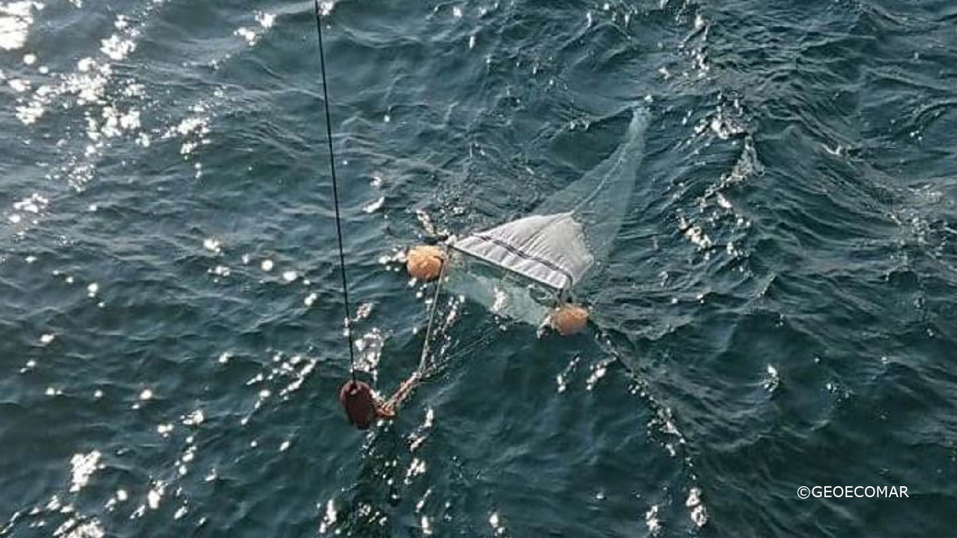
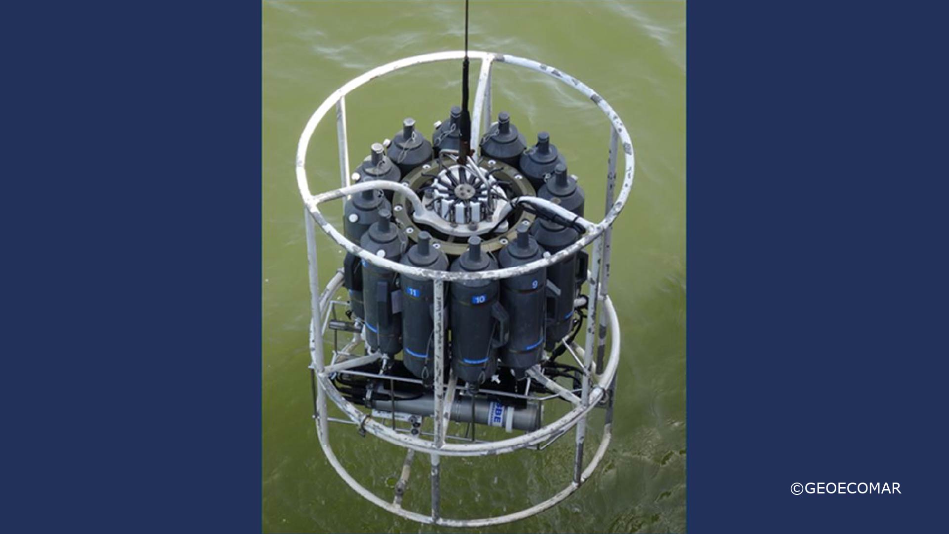
CTD/Plankton sampling
CTD Rosette system: SBE 32C Carusel water Sampler with 12 five liters bottles
Multi-Beam(s)/Sub Bottom profiling
Multibeam Elac Nautik Seabeam 1050 D, 50 kHz, 180 kHz
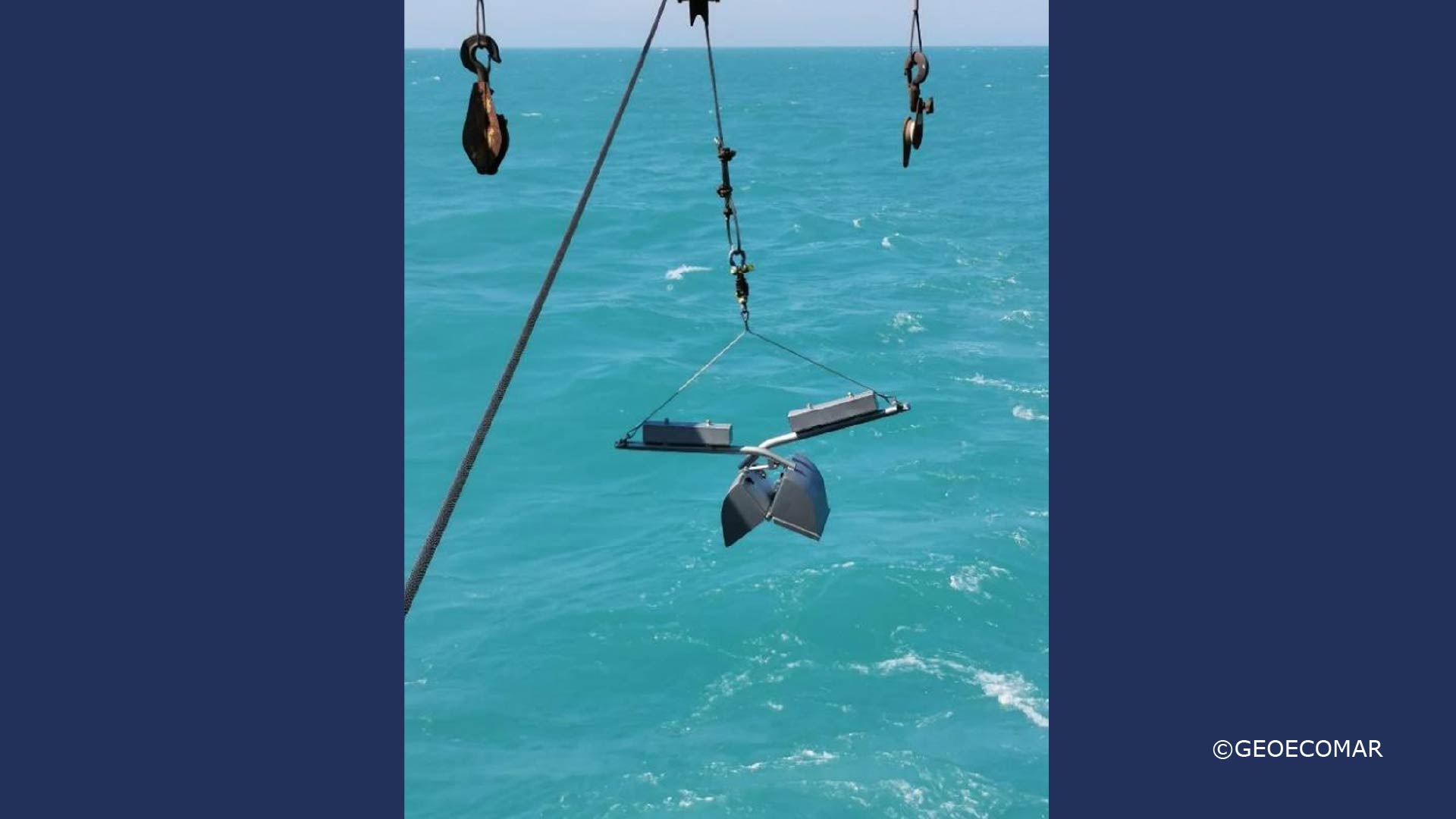
Coring/Sampling Capabilities
Gravity Corer, 6 m length
MIDICORER MARK II-400 with 4 tubes, 60 cm length, 10 cm ID
Winches
Steel Wire Length: 2500 m, safe working load: 7.2 tonnes
Conducting Cable Length: 2000 m, safe working load: 8 tonnes
Other Winches: CTD Length: 2500 m
Communications
Satellite communications: Trac Phone V11 IP V11 V7IP and V7 Rate sheet gA4 0613, KVH Industries, USA, 2015, VHV Radio
Suitable Surveys
Multipurpose research vessel, which carries out a wide variety of survey operations in offshore as well as deep sea locations, acoustic and oceanographic surveys, buoy handling operations, environmental sampling, geological, geophysical and hydrographic surveying
Scientific Limitations
No Fisheries
Vessel capability to support ROV deployment
Only in Shallow Water
Support offered to AQUARIUS users
Multipurpose research vessel, which carries out a wide variety of survey operations in offshore as well as deep sea locations, acoustic and oceanographic surveys, buoy handling operations, environmental sampling, geological, geophysical and hydrographic surveying. RV Mare Nigrum can provide a range of additional mobile equipment for various tasks including a variety of grabs and corers, and additional sampling equipment.
Infrastructure Availability and Contact Details
Year 2025
1) 29° 46′ 02.0219″ E
32° 52′ 24.8866″ E
32° 49′ 47.1296″ E
28° 11′ 50.1956″ E
44° 51′ 02.6540″ N
43° 51′ 23.4482″ N
42° 45′ 04.0726″ N
42° 51′ 35.6625″ N
2) MARCH-OCTOBER
3) CONSTANTA
Year 2026
1) 29° 46′ 02.0219″ E
32° 52′ 24.8866″ E
32° 49′ 47.1296″ E
28° 11′ 50.1956″ E
44° 51′ 02.6540″ N
43° 51′ 23.4482″ N
42° 45′ 04.0726″ N
42° 51′ 35.6625″ N
2) MARCH-OCTOBER
3) CONSTANTA
Year 2027
1) 29° 46′ 02.0219″ E
32° 52′ 24.8866″ E
32° 49′ 47.1296″ E
28° 11′ 50.1956″ E
44° 51′ 02.6540″ N
43° 51′ 23.4482″ N
42° 45′ 04.0726″ N
42° 51′ 35.6625″ N
2) MARCH-OCTOBER
3) CONSTANTA
Contact email for applicants to discuss the initial feasibility of their work while they prepare their application
Please direct all queries to the AQUARIUS Coordination Office: aquarius[at]marine.ie
Certification and Clearance Requirements
Medical Certification Requirements
NA
Are additional medical checks required?
NA
Survival training certification required for joining vessel
NA
Additional certification required
NA
Diplomatic clearance or other permits required and any relevant information about the application process
NA
Any additional clearances required for area or type of activity
NA